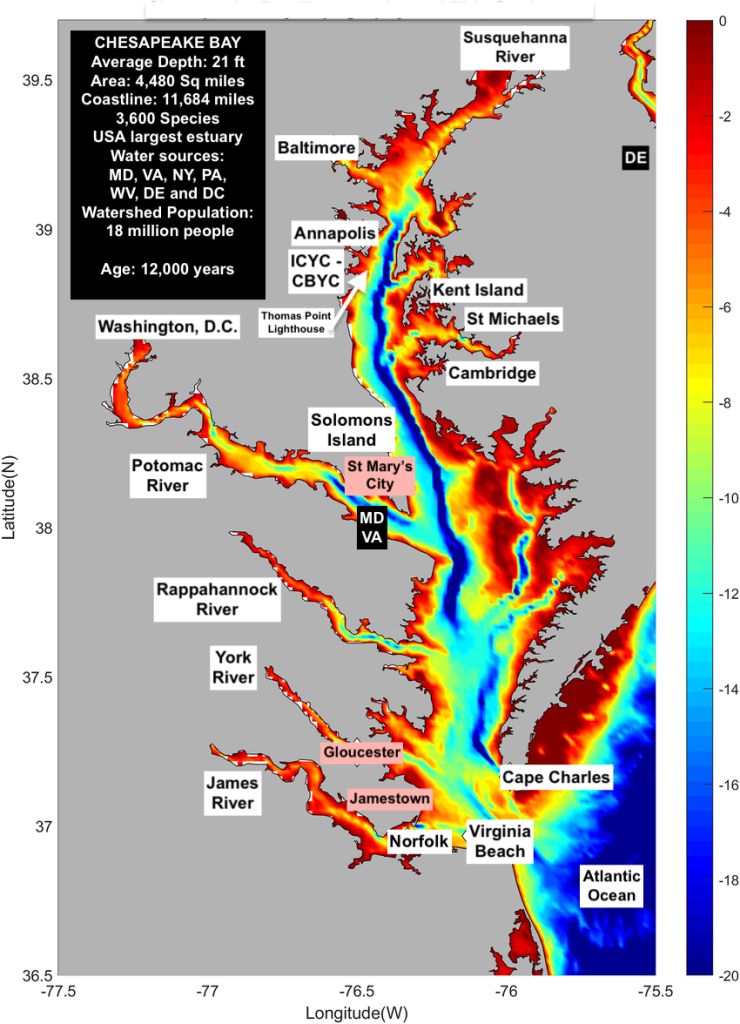
Answer: Not very…. While the Chesapeake Bay is 4,480 square miles in area (four times the area of the state of Rhode Island!), it only averages 21 feet in depth.
The Shallows
Have a look at this map. As you can see, the majority of the Chesapeake Bay is very shallow, as indicated by the red, orange, yellow and green colors – all less than 10 feet deep.

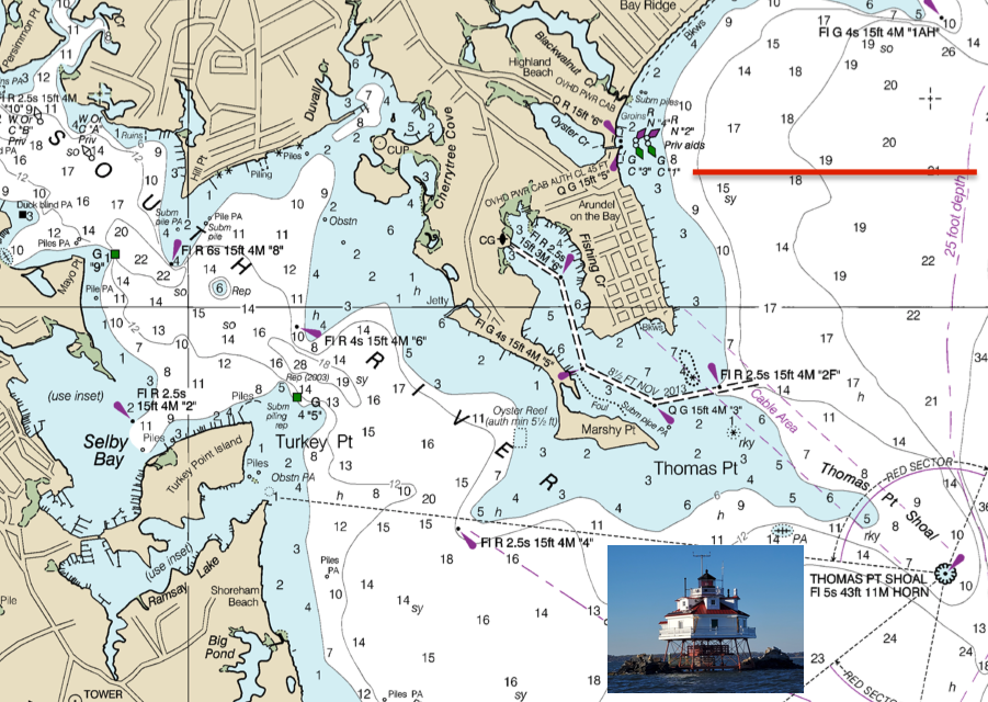
At the Thomas Point Shoal Lighthouse, for example, you can walk about two thirds of the way from the Point itself towards the Lighthouse and not get your hair wet, with depths under 5 feet.

Boaters have to be very careful where they go for caution of running aground! Our sailboat, Therapy, has a draft of 6 feet, for example, so we generally stay clear of the shore, unless we know where the channels are (we do); mostly, we sail along the rivers and open Bay. Conversely, Irie Vibes and Tallawah have a much shallower drafts, so we can get closer to the beaches, wetlands and forests; sometimes we even run onto a sandbar or beach and walk ashore, as we do in the Rhode River.
This shallow depth has considerable advantages to the wildlife that inhabits the Chesapeake Bay. On our Storyteller – Natural History Charter, we sometimes venture ashore with nets and sieves to sample the amazing ecology along the shoreline. Turtles and shore birds often make the nests and lay eggs on the sandy shoreline above the high-water mark. Reeds, grasses and sedges that grow along the shoreline, marshes, swamps and shallows provide food and shelter to invertebrates and young fish. Grasses, sometimes covering hundreds of acres, extend across the shallows providing food for ducks and small fish. They also shelter blue crabs. The bottom of the shallows is generally sand, clay, mud and are occasionally rocky. Shallows host beds of oysters too. Generally, oyster spats have latched onto old oyster shells and can build substantial reefs. The shallowness facilitates the water getting warm, facilitating photosynthesis. Shallows are a massive biological factory!
Deeper Water
Areas where the depth is deeper than 10 feet are indicated by blue areas on the map and are mostly in the central channel running more along the eastern shore. The reason for this actually relates to events 43 million years ago (asteroid impact close to Norfolk, VA) and 20,000 – 10,000 years ago (melting of the ice cap to our north at the end of the ice age and the direction of the Susquehanna River which gouged out the deeper parts of the Chesapeake Bay). There are channels that head inland which are mostly flooded river valleys. Fishing and oyster boats, as well as ocean going ships, adhere to these channels and have created many prosperous ports, including Annapolis, St Michaels and the Port of Baltimore on the Patapsco River.
Deeper waters away from land are our destination for the sailboat, as there are fewer boats, better winds and a serene connection to the environment. We get great views of the ocean-going ships too. The wildlife is different – more seabirds, for example. Chesapeake Bay waters in spring and summer contain massive shoals or herring, rockfish and bluefish, often chased by dolphins and ospreys. It’s a different world….
